Home | About Us | Maps | Animal Facts
Home | About Us | Maps | Animal Facts
Species Code: TUMI
|
This species is common in almost all habitats throughout the state except large dry and cultivated fields and alpine rocks/ice. In agricultural areas, Robins can be found where trees occur, especially around towns, farmhouses, or wetlands.
All zones except Permanent Ice/Snow were core; estuarine mud flats ;bare ground; sparse vegetation in steppe; grassland, shrub savanna, shrubland, and non-irrigated agriculture in steppe zones; high density development; and mid-to-large-seral conifer forests in wet, west-side forest zones.
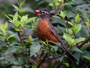
The American Robin is perhaps the most ubiquitous bird in Washington. It can be found breeding in almost any habitat in the state, with the exception of dense rain forests, non-vegetated glaciers and rock, and intact sagebrush tracts.
Translated from the Washington Gap Analysis Bird Volume by Uchenna Bright
Text edited by Gussie Litwer
Map by Dave Lester

 = Core Habitat
 = Marginal Habitat