NatureMapping Activities
Student Guide
Latitude and Longitude (Lat/Long)
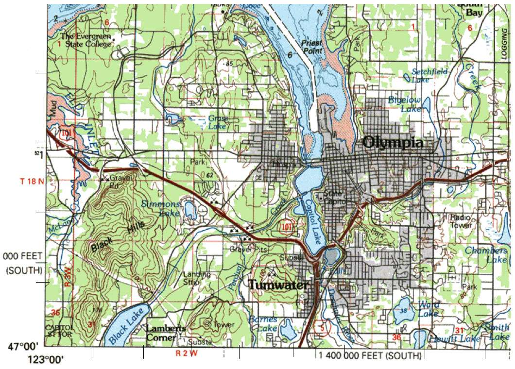
Mapping Practice for Thurston County
Instructions
- View the map below and find the Lat/Long for the circled location.
- Remember:
There are 60 minutes in a Degree
60 seconds in a minute. - Latitude increases as you go north
- Longitude increases as you go west
- Tick marks along the edge of the map are one minute increments
Question:
What is at latitude 47°04'30" and longitude 122°58'45"?
This is a 7.5 minute (1:24,000) quadrangle (quad) map.
The red circle shows the latitude and longitude for the northwest corner of the map.
The black circles are 2.5 minutes (2"30") less than the coordinates in the corner.
Home |
About Us |
How to Participate |
Biodiversity Modules |
Projects |
Maps |
News |
Resources
© 2008 NatureMapping