
Home | About Us | How to Participate | Biodiversity Modules | Projects | Maps | News | Resources
Home | About Us | How to Participate | Biodiversity Modules | Projects | Maps | News | Resources
Species Code: FASP
Legend: Breeding Range Map Metadata (Data about data or how the map was made) Click to enlarge distribution map Map with Breeding Bird Atlas records
|
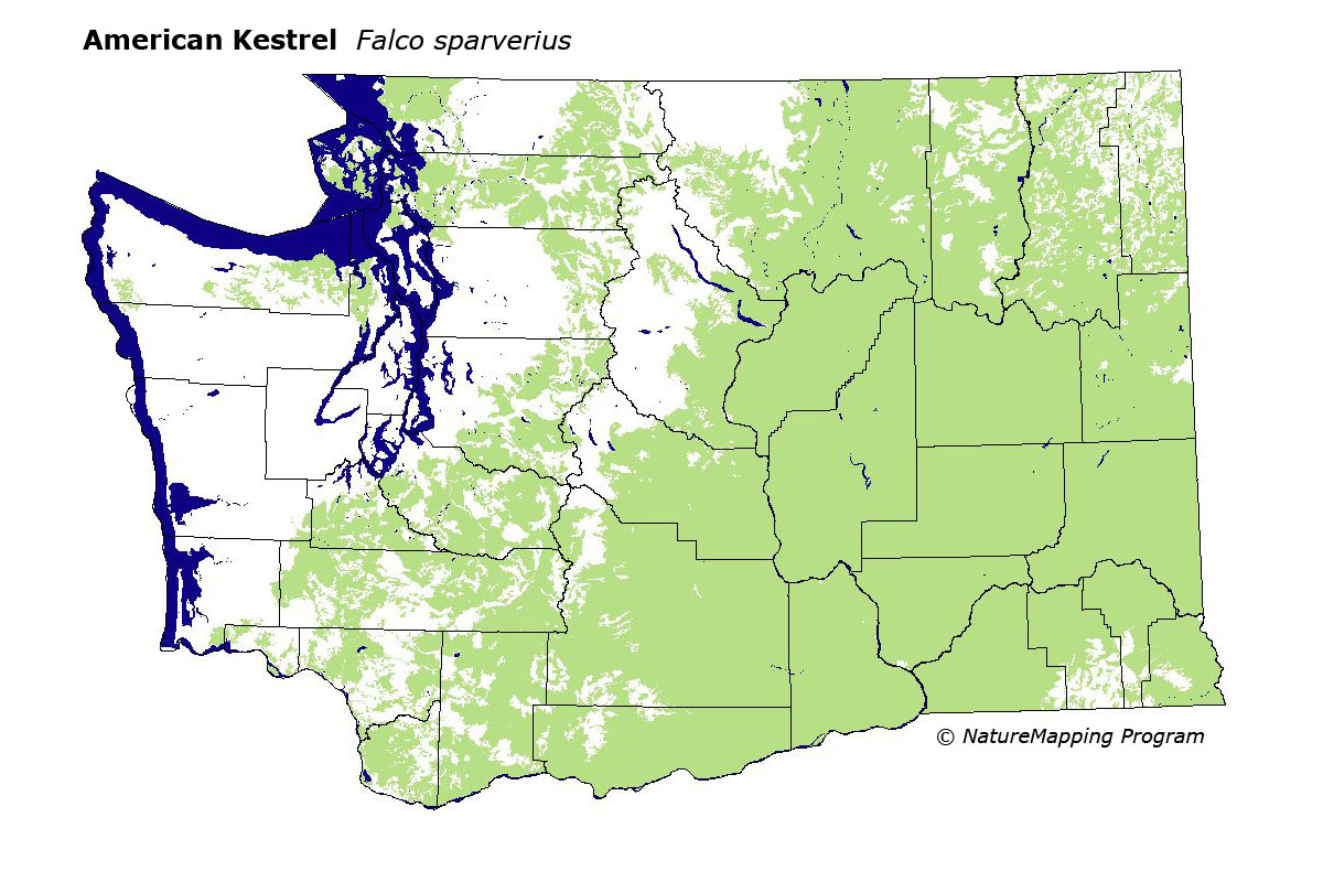
This species is common in most open habitats at lower elevations in eastern Washington, and are locally uncommon in similar habitats of western Washington. They prefer open habitats such as agricultural areas, grasslands, and sagebrush. Kestrels need a cavity for nesting, sometimes using cliffs when tree cavities are not available. In western Washington, they are found locally in the southern Puget Trough, along the upper Skagit River, and in eastern King and Pierce Counties, south to the Trout Lake area, and locally above the treeline along the Cascade crest.
All of the zones within its range limits were core areas of use. In the steppe zones all habitats were good except mid- to high-density development. In the driest forest zones (Ponderosa Pine and Oak) all habitats were good except mid- to high-density development and closed forest. In all other forested zones and Alpine/Parkland, only agriculture and open areas (meadows, clear-cuts, shrubs, parkland, etc.) were good.
In western Washington the kestrel occurs locally in a variety of vegetation zones where appropriate habitat is found. In eastern Washington, it is abundant in a wide variety of open habitats. At higher elevations, kestrels become somewhat local breeders occurring where conditions are suitable, including higher elevation cuts and burns, parkland in sub-alpine forest zones and the Alpine/Parkland zone, and open grassy slopes or meadows. For example, kestrels have been seen in meadows in Kittitas County at 6000 feet and in clear-cuts in the Blue Mountains at 5000 feet. Kestrels show a preference for relatively dry foraging areas, a probable reason for their absence as a breeder in most of the Olympic Peninsula.
Translated from the Washington Gap Analysis Bird Volume by Uchenna Bright
Text edited by Gussie Litwer
Webpage designed by Dave Lester
 = Core Habitat
 = Marginal Habitat