Home | About Us | How to Participate | Biodiversity Modules | Projects | Maps | News | Resources
Home | About Us | How to Participate | Biodiversity Modules | Projects | Maps | News | Resources
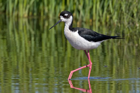
Species Code: HIME
|
Metadata (Data about data or how the map was made)
Habitat
This species is a locally uncommon colonial breeder in freshwater ponds and wetlands in the Columbia Basin notably the Potholes area, Lake Lenore, southeastern Yakima County, and Rearden.
Good habitat in the core areas of use included all freshwater bodies and wetlands in the Central Arid Steppe, Big Sage/Fescue, Wheatgrass/Fescue, and Three-tip Sage zones, but was limited to the areas with known breeding colonies.
Prior to 1973, the Black-necked Stilt was not known to breed in Washington. The first record for Washington was an individual collected on May 27, 1928 near Satus. The second and third records were a pair collected at Rearden on May 8, 1960. A pair in 1973 in Grant County provided the first nesting record for Washington followed by five more pairs in 1977. According to some, these initial records corresponded with dry years in southwestern states, which forced the stilts north to Washington where they have been established locally.
Translated from the Washington Gap Analysis Bird Volume by Uchenna Bright
Text edited by Gussie Litwer
Webpage designed by Dave Lester

 = Core Habitat
 = Marginal Habitat