
Home | About Us | How to Participate | Biodiversity Modules | Projects | Maps | News | Resources
Home | About Us | How to Participate | Biodiversity Modules | Projects | Maps | News | Resources
Species Code: DEOB
Legend: Breeding Range Map Metadata (Data about data or how the map was made) Click to enlarge distribution map Map with Breeding Bird Atlas records
|
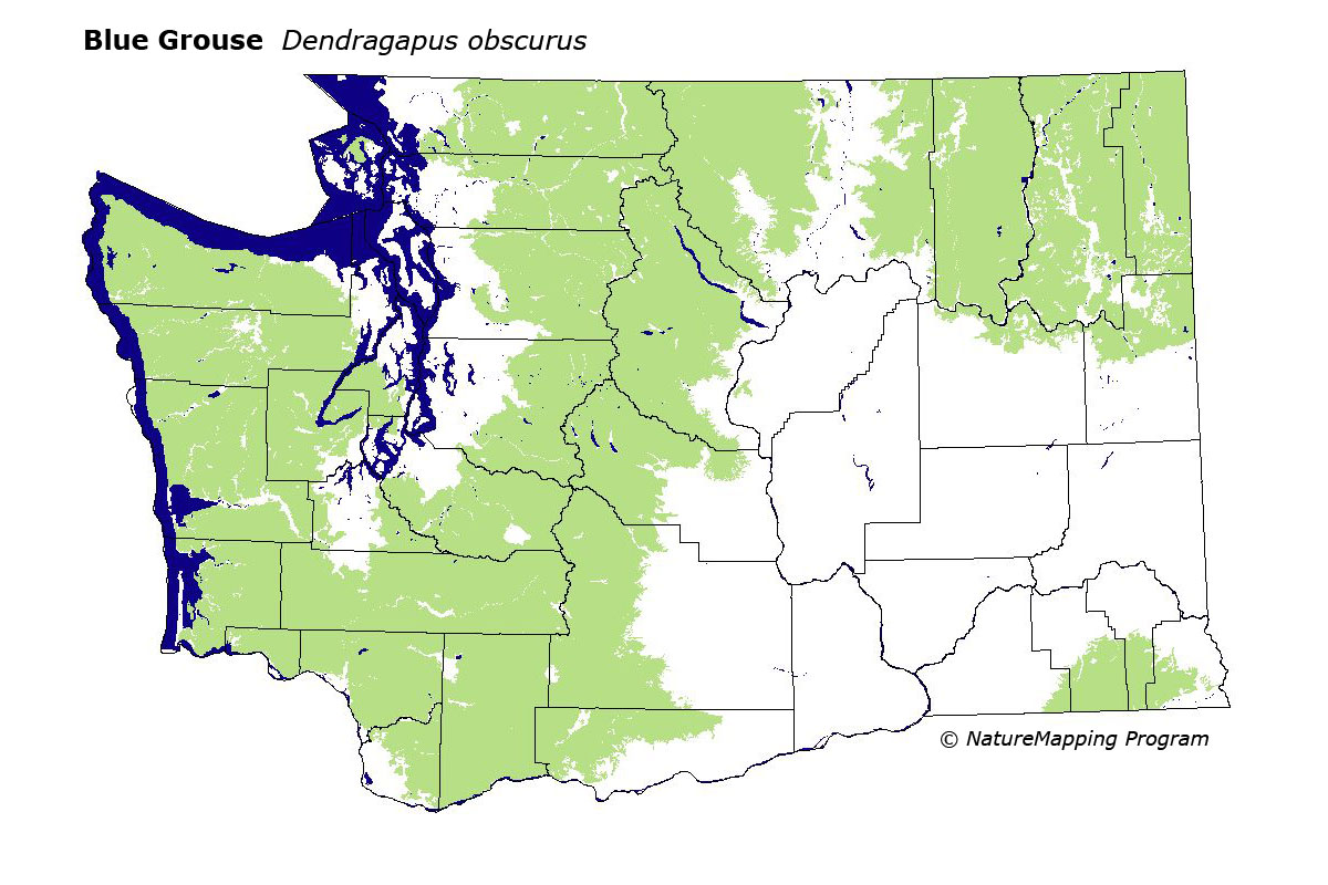
This species is common in mixed coniferous forests at all elevations throughout most of the state. They are uncommon in similar habitats in the Blue Mountains. Principally, they are found in mountainous areas, though they occur down to the coastline on the Olympic Peninsula. This Grouse is local in the Puget Trough, near Fort Lewis. They are uncommon in forests dominated by Lodgepole Pine and Engelmann Spruce in the North Cascades and Pasayten area, where the Spruce Grouse largely replaces it.
Good habitat in core areas of use included all mixed and coniferous forests and clearings in forest above the steppe zones.
The Blue Grouse exists at very low elevation forests along the coast, and in mixed forests just above the Puget Trough. In Washington, breeding bird survey data show a significant population decrease of 1.9% per year from 1966 to 1991.
Translated from the Washington Gap Analysis Bird Volume by Uchenna Bright
Text edited by Gussie Litwer
Webpage designed by Dave Lester
 = Core Habitat
 = Marginal Habitat