
Home | About Us | How to Participate | Biodiversity Modules | Projects | Maps | News | Resources
Home | About Us | How to Participate | Biodiversity Modules | Projects | Maps | News | Resources
Species Code: DOOR
Legend: Breeding Range Map Metadata (Data about data or how the map was made) Click to enlarge distribution map Map with Breeding Bird Atlas records
|
Locally common in irigated hayfields in northeastern Washington and at Toppenish National Wildlife Refuge in south-central Washington (Yakima County).
Good habitat in core areas of use included riparian wetlands with emerfgent vegetation, rivers, and irrigated agriculture, limited to areas with known colonies.
Bobolinks nest in loose "colonies" in Washington which is the westernmost end of their known distribution. The colony at Toppenish Nainal Wildlife Refuge is probably the westernmost Bobolink colony in North America. It was the first in Washington with confirmed nesting activity, with eggs discovered in 1977.
Translated from the Washington Gap Analysis Bird Volume by Uchenna Bright
Text edited by Gussie Litwer
Webpage designed by Dave Lester
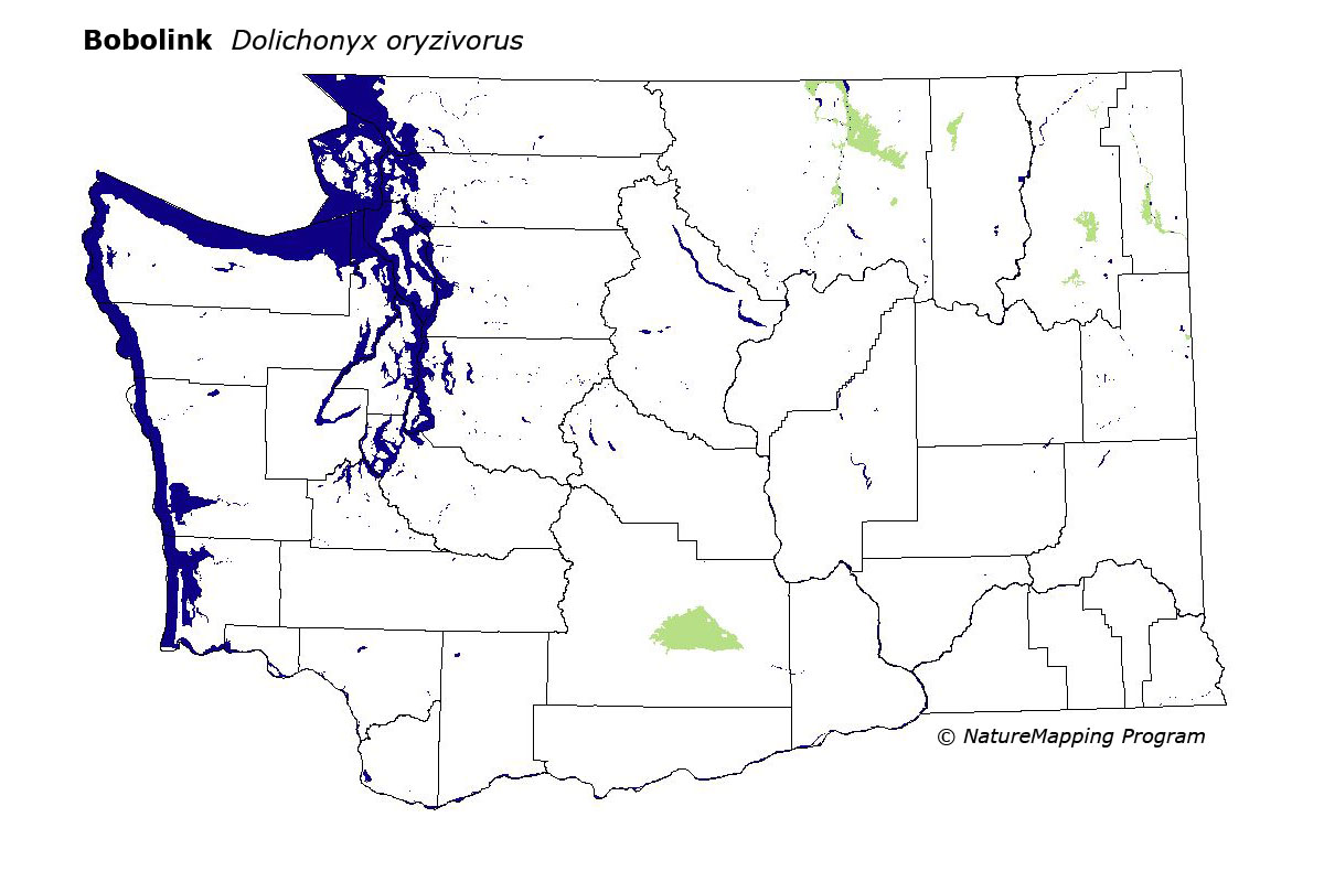
 = Core Habitat
 = Marginal Habitat