
Home | About Us | How to Participate | Biodiversity Modules | Projects | Maps | News | Resources
Home | About Us | How to Participate | Biodiversity Modules | Projects | Maps | News | Resources
Species Code: CATME
Legend: Breeding Range Map Metadata (Data about data or how the map was made) Click to enlarge distribution map
|
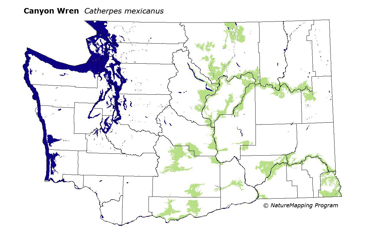
The Canyon Wren is locally fairly common in deep rocky canyons of eastern WashingtonŐs steppe zones, and at low elevations along the east slopes of the Cascades.
Good habitat in core zones included cliffs, rocky outcroppings, steppe habitat adjacent to rivers, and rivers in parts of steppe, Oak, and Ponderosa Pine zones that encompass deep rocky canyons.
Western Washington records are rare and show no probable evidence of nesting. This species occurs widely across eastern Washington in many areas where Rock Wrens also occur, but Canyon Wrens typically are found in only the steepest canyons in the region.
Translated from the Washington Gap Analysis Bird Volume by Uchenna Bright
Text edited by Gussie Litwer
Webpage designed by Dave Lester
 = Core Habitat
 = Marginal Habitat