
Home | About Us | How to Participate | Biodiversity Modules | Projects | Maps | News | Resources
Home | About Us | How to Participate | Biodiversity Modules | Projects | Maps | News | Resources
Species Code: URAA
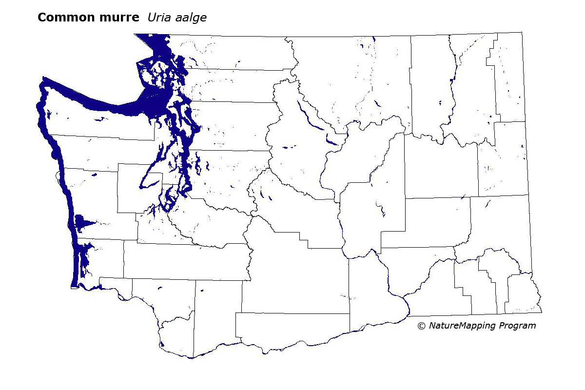
Legend: Breeding Range Map Metadata (Data about data or how the map was made) Click to enlarge distribution map Map with Breeding Bird Atlas records
|
This species is locally common on islets of the outer coast from Grays Harbor to Cape Flattery.
Good habitats in the core areas of use included coastal rocky cliffs in the Sitka Spruce zone, limited to known breeding islands.
Washington individuals belong to the North American subspecies U. a. inornata, formerly further subdivided as U.a. californica. The most current population data are based on helicopter surveys. Numbers typically fluctuate annually, based on food supply and climatic events, but have severely declined in recent years. El Nino/Southern Oscillation events and overfishing negatively affect previous four years. Prior to warming events, the number of murres stayed around 3000 until at least 1990. Common Murres have been the most frequent avian victims of oil spills along the Washington coastline.
Translated from the Washington Gap Analysis Bird Volume by Uchenna Bright
Text edited by Gussie Litwer
Webpage designed by Dave Lester
 = Core Habitat
 = Marginal Habitat