
Home | About Us | How to Participate | Biodiversity Modules | Projects | Maps | News | Resources
Home | About Us | How to Participate | Biodiversity Modules | Projects | Maps | News | Resources
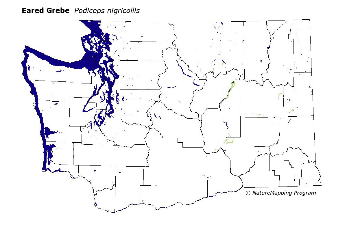
Species Code: PODNI
Legend: Breeding Range Map Metadata (Data about data or how the map was made) Click to enlarge distribution map
|
This species is locally common in eastern WashingtonÕs large ponds and lakes at lower elevations throughout the Columbia basin and Okanogan valley.
Good habitats in core areas of use were larger lakes or reservoirs in the Central Arid Steppe, Big Sage/Fescue, Three-tip Sage, Palouse, Ponderosa Pine near Turnbull in Spokane County, and throughout the channeled scablands. However, the Eared Grebe is apparently not present in much of the western Columbia basin especially eastern Yakima and Kittitat Counties.
The exclusion of this species from southeastern Washington is based on a lack of records. BBA data are scarce, but the Eared Grebe probably nests in many large ponds and lakes throughout southern and southeastern Washington. Eared Grebes have a high tolerance of salinity which allows them to nest in most eastern Washington water bodies. Developing vegetation is necessary for nesting as this GrebeÕs nest is a floating vegetation mat in shallow water. Like other grebes, this species is not found nesting in flowing rivers.
Translated from the Washington Gap Analysis Bird Volume by Uchenna Bright
Text edited by Gussie Litwer
Webpage designed by Dave Lester
 = Core Habitat
 = Marginal Habitat