
Home | About Us | How to Participate | Biodiversity Modules | Projects | Maps | News | Resources
Home | About Us | How to Participate | Biodiversity Modules | Projects | Maps | News | Resources
Species Code: TYTY
Legend: Breeding Range Map Metadata (Data about data or how the map was made) Click to enlarge distribution map
|
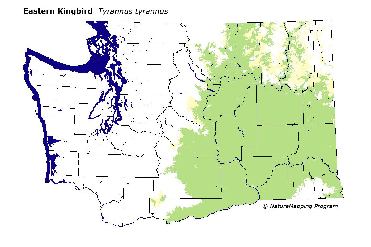
This species is common at lower elevations in eastern washington. It forages in steppe and agricultural habitats and breeds in wetlands with hardwood trees or other sites with groves of hardwood trees (e.g., golf courses). It is local and rare in western Washington.
Core zones were in steppe, Oak and Ponderosa Pine, peripherally in Interior Douglas-fir. It was not modeled in western Washington due to scarcity of breeding records.
Eastern and Western Kingbirds often occupy the same foraging habitat, but their nesting habitats differ. Eastern Kingbirds prefer to nest in wetlands with hardwood growth; Western Kingbirds prefer upland trees or wooden utility poles.
Translated from the Washington Gap Analysis Bird Volume by Uchenna Bright
Text edited by Gussie Litwer
Webpage designed by Dave Lester
 = Core Habitat
 = Marginal Habitat