
Home | About Us | How to Participate | Biodiversity Modules | Projects | Maps | News | Resources
Home | About Us | How to Participate | Biodiversity Modules | Projects | Maps | News | Resources
Species Code: AQCH
Legend: Breeding Range Map Metadata (Data about data or how the map was made) Click to enlarge distribution map
|
This species is common in open dry forests of eastern Washington, where precipitous terrain creates suitable nesting cliffs and are uncommon in the Olympic rain shadow and in northeastern Washington at lower elevations. They are also uncommon in southeastern Washington along the Snake and Grande Ronde Rivers. In the southern Cascades it is uncommon and local. This species is most common where large, rocky cliffs occur for nesting habitat, and suitable prey (especially rabbits and marmots) is available. West of the Cascade crest they are found in rain shadows of major volcanoes (Mt. Adams, Mt. St. Helens, Mt. Rainier, and Mt. Baker), at high elevations in alpine parkland, and in clearcuts at moderate elevations. At higher elevations they are often seen foraging in rocky alpine areas.
In the Cascade Mountains, Okanogan Highlands, and Northeast regions the core areas of use were Alpine/Parkland, Mountain Hemlock, Subalpine Fir, Interior Douglas-fir (but not in the Northeast region where this zone occurs on less rugged terrain), Ponderosa Pine, Oak, and adjacent steppe zones. In the Olympic/San Juan Islands the core areas of use were Alpine/Parkland, Mountain Hemlock, Silver Fir, Subalpine Fir, and Olympic Douglas-fir in the Olympics; and Puget Sound Douglas-fir and Woodland/Prairie Mosaic on San Juan and Orcas Islands. In southeastern Washington the core areas of use were steppe zones along the Snake and Grande Ronde Rivers. Good habitats in all core areas of use were meadows, cuts in forest, alpine/sub-alpine parkland, steppe, and open forest. Non-irrigated agriculture was adequate.
This species' distribution is apparently limited by the presence of large rocky cliffs more than any other factor. Its occurrence in western Washington is interesting, following the Cascade crest, where it spills over rocky from eastern Washington, but this species also occurs wherever dry, open forests are combined with large rocky cliffs, as in the rain shadows mentioned above. Its favored food items are mid-sized mammals, especially rabbits, ground squirrels, and marmots.
Translated from the Washington Gap Analysis Bird Volume by Uchenna Bright
Text edited by Gussie Litwer
Webpage designed by Dave Lester
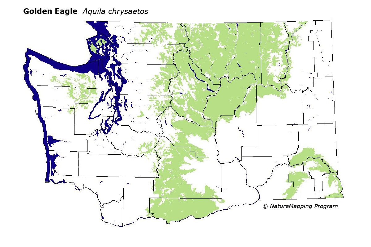
 = Core Habitat
 = Marginal Habitat