
Home | About Us | How to Participate | Biodiversity Modules | Projects | Maps | News | Resources
Home | About Us | How to Participate | Biodiversity Modules | Projects | Maps | News | Resources
Species Code: DUCA
Legend: Breeding Range Map Metadata (Data about data or how the map was made) Click to enlarge distribution map
|
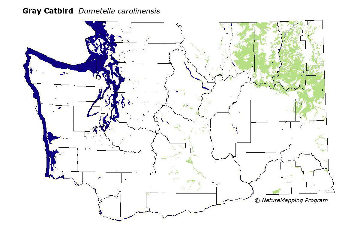
This species is uncommon to common in dense, shrubby riparian vegetation in the ecotone between low-elevation conifer forest and steppe in eastern Washington. It is more common in the northern part of its range, in the Methow, Okanogan, Sanpoil, Kettle, Columbia, Colville, and Pend Oreille River Valleys. In Yakima County, this species extends well below forest areas along the Yakima River. In the Palouse region, it can also be found in shrubby, riparian vegetation dominated by Rosa.
Core zones were the steppe zones at the edge of the Columbia Basin and forest zones up to and including the Grand Fir zone. Water/wetlands were good habitats.
The Gray Catbird apparently does not occur in the Oregon Cascades as a breeder. Gilligan et al (l994) reported it from Wasco County in Oregon during the breeding season, but with no other evidence of breeding.
Translated from the Washington Gap Analysis Bird Volume by Uchenna Bright
Text edited by Gussie Litwer
Webpage designed by Dave Lester
 = Core Habitat
 = Marginal Habitat