
Home | About Us | How to Participate | Biodiversity Modules | Projects | Maps | News | Resources
Home | About Us | How to Participate | Biodiversity Modules | Projects | Maps | News | Resources
Species Code: VIHU
Legend: Breeding Range Map Metadata (Data about data or how the map was made) Click to enlarge distribution map Map with Breeding Bird Atlas records
|
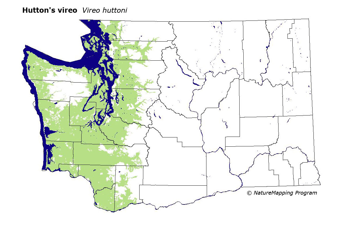
The Hutton's Vireo is uncommon at low elevations in forests of western Washington, generally below 1500 feet. It is not found in mature rain forests of the Olympic National Park.
Core zones were those below the Silver Fir zone in western Washington. Good habitats were water/wetlands (except estuarine mud flats), openings and clearings in forest, and all forest except mid-and all forest except mid-and late-seral conifer forests. Low-density development and pastures were adequate.
The Hutton's Vireo occurs in a variety of forested habitats and brushy clearings, but typically in low numbers. It is most often found in hardwood or mixed second-growth with a strong hardwood component. Though they occur elsewhere throughout the Olympic Peninsula and Willapa Hills, Hutton's Vireos are absent from the remnant rain forest of Olympic National Park. This species has surely benefited from logging practices that have created extensive second-growth forest stands with a large hardwood component.
Translated from the Washington Gap Analysis Bird Volume by Uchenna Bright
Text edited by Gussie Litwer
Webpage designed by Dave Lester
 = Core Habitat
 = Marginal Habitat