
Home | About Us | How to Participate | Biodiversity Modules | Projects | Maps | News | Resources
Home | About Us | How to Participate | Biodiversity Modules | Projects | Maps | News | Resources
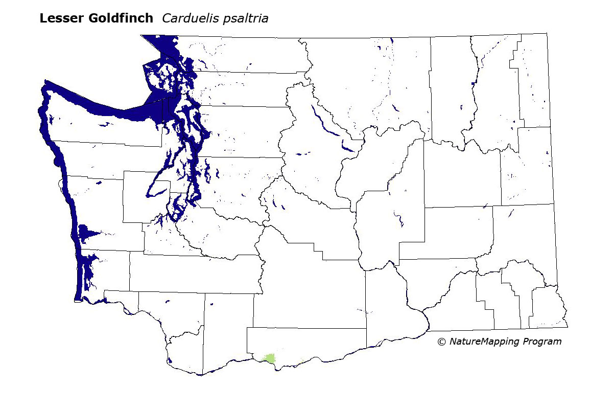
Species Code: CAPS
Legend: Breeding Range Map Metadata (Data about data or how the map was made) Click to enlarge distribution map Map with Breeding Bird Atlas records
|
This goldfinch is uncommon and very local in the State of Washington in oaks of southwestern Klickitat County.
Core areas were the Klickitat Meadow Steppe and Oak zones. Good habitats were low-density development, pastures, steppe, forest openings, riparian areas, and hardwood and mixed forests.
Washington breeders represent the northern subspecies C. p. hesperophilus. The species has been found in Washington only along the southern edge of Klickitat County, and always in association with Garry Oaks. Washington birds are at the northern limit of the species' range. It generally inhabits scattered trees, woodland edge, second growth, open fields, pastures and developed areas.
Translated from the Washington Gap Analysis Bird Volume by Uchenna Bright
Text edited by Gussie Litwer
Webpage designed by Dave Lester
 = Core Habitat
 = Marginal Habitat