
Home | About Us | How to Participate | Biodiversity Modules | Projects | Maps | News | Resources
Home | About Us | How to Participate | Biodiversity Modules | Projects | Maps | News | Resources
Species Code: ZEMA
Legend: Breeding Range Map Metadata (Data about data or how the map was made) Click to enlarge distribution map Map with Breeding Bird Atlas records
|
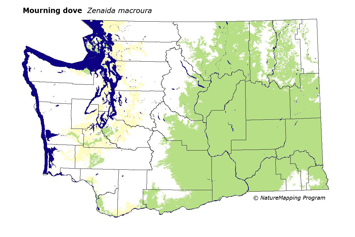
This species is common and widespread throughout eastern Washington at low elevations from steppe zones up to the Douglas-fir zone, and in western Washington at low elevations along the Puget Trough and south to Vancouver. It utilizes a variety of habitats, including cities, wetlands, steppe, agriculture, prairies, and clear cuts. Its range is expanding in western Washington, and Mourning Doves use logged areas in forested regions.
Core area of use on the east side were zones up to and including Interior Douglas-fir. In steppe zones, all habitats except high-density development were good. In Oak, Ponderosa Pine, and Interior Douglas-fir, low- to mid-density development, agriculture, and open areas were good. Core areas of use on the west-side were the Woodland/Prairie Mosaic, Cowlitz River, and Willamette Valley zones. The Western Hemlock and Puget Sound Douglas-fir zones were peripheral areas of use. Farms, openings in forest, and parks were good habitats.
Washington breeders represent the western subspecies Z. m. marginella. In western Washington, this species was formerly restricted to the prairie zones. Currently, agriculture practices, clearing of land for development, and managed forest practices have increased the amount of available habitat in western Washington. Due to tree plantings in farmlands and an increased number of structures available in eastern Washington, the amount of breeding habitat available have increased.
Translated from the Washington Gap Analysis Bird Volume by Uchenna Bright
Text edited by Gussie Litwer
Webpage designed by Dave Lester
 = Core Habitat
 = Marginal Habitat