
Home | About Us | How to Participate | Biodiversity Modules | Projects | Maps | News | Resources
Home | About Us | How to Participate | Biodiversity Modules | Projects | Maps | News | Resources
Species Code: PORCA
Legend: Breeding Range Map Metadata (Data about data or how the map was made) Click to enlarge distribution map
|
This species is fairly common in freshwater marshes and wet meadows on both sides of the Cascades. They were limited to lowlands in western Washington where they are less common, but they are more common in eastern Washington, breeding up to 4000 feet. Also occurs in lesser numbers in brackish marshes. They will utilize wet areas in agricultural fields.
The core areas of use were all east-side zones below Subalpine Fir and, on the west side, Puget Sound Douglas-fir, Woodland Prairie Mosaic, and locally in Western Hemlock. Fresh water/wetlands were good and estuarine grasslands were adequate. Irrigated fields in steppe, Ponderosa Pine, and Oak zones, and all agricultural fields in other forested zones were included knowing there may be smaller pockets of habitat suitable for the Sora if the appropriate habitat (wetlands) below our mapping resolution was present within the larger mapped habitat.
Soras are often found in the company of Virginia Rails at lower elevations, though Soras can occur in habitats with less water and at higher elevations than Virginia Rails. They can occupy marshes of many different types, including cattail-dominated sites at low elevations, such as at the Toppenish National Wildlife Refuge, and moist sedge meadows in cooler, higher areas, such as near Mount Bonaparte.
Translated from the Washington Gap Analysis Bird Volume by Uchenna Bright
Text edited by Gussie Litwer
Webpage designed by Dave Lester
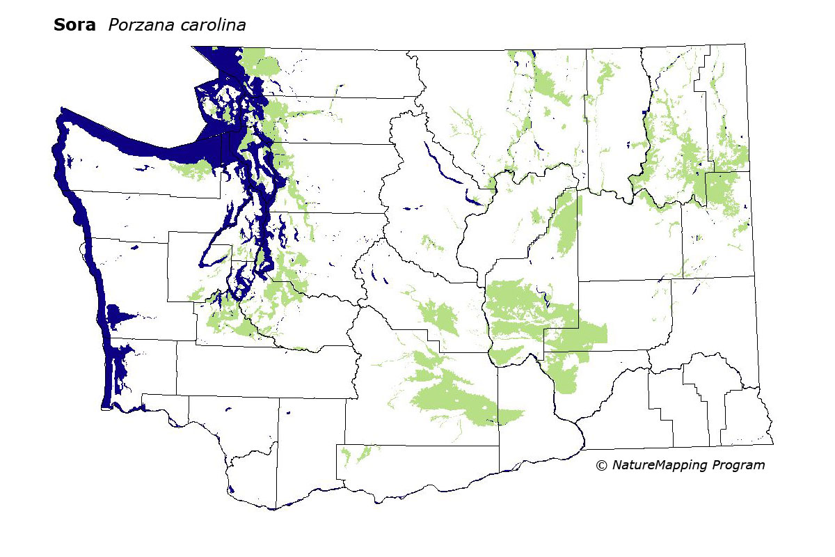
 = Core Habitat
 = Marginal Habitat