
Home | About Us | How to Participate | Biodiversity Modules | Projects | Maps | News | Resources
Home | About Us | How to Participate | Biodiversity Modules | Projects | Maps | News | Resources
Species Code: DETO
Legend: Breeding Range Map Metadata (Data about data or how the map was made) Click to enlarge distribution map Map with Breeding Bird Atlas records
|
This warbler is common in conifer forests at moderate and high elevations throughout the state, especially in Douglas-fir stands at least 50 years old and 20 acres in size. In Western Washington it is generally found above 500 feet, but it does occur lower in areas dominated by Douglas-fir. In Eastern Washington, it is found above the Ponderosa Pine zone in all conifer forests, and locally within the Ponderosa Pine zone where Douglas-fir patches are present. The Townsend's Warbler breeds up to sub-alpine forests all along the Cascade crest and at high elevations on Mount Rainier.
Zones within its range limits and above the (peripheral) Ponderosa Pine zone were core. Mid-to late seral conifer forests were good, and mixed forests and early-seral conifer forests were adequate, except in the Ponderosa Pine zone, where only closed conifer forests were included.
Translated from the Washington Gap Analysis Bird Volume by Uchenna Bright
Text edited by Gussie Litwer
Webpage designed by Dave Lester
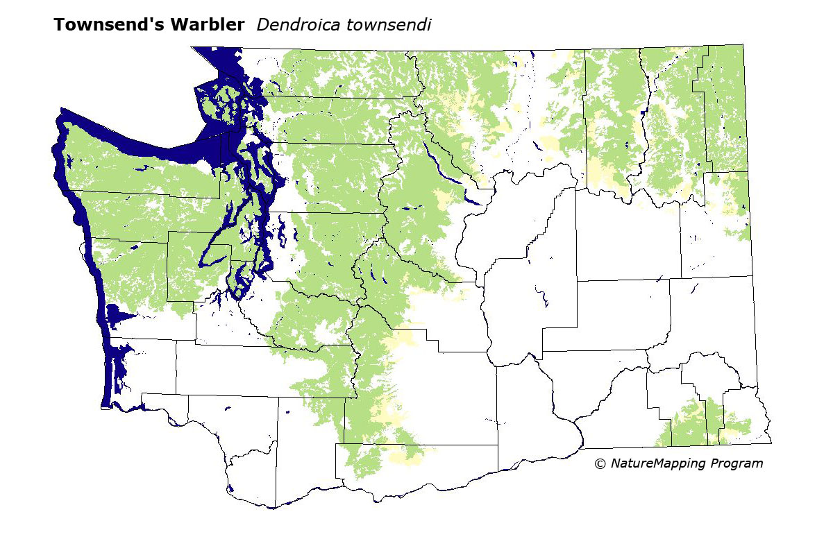
 = Core Habitat
 = Marginal Habitat