
Home | About Us | How to Participate | Biodiversity Modules | Projects | Maps | News | Resources
Home | About Us | How to Participate | Biodiversity Modules | Projects | Maps | News | Resources
Species Code: CAFU
Legend: Breeding Range Map Metadata (Data about data or how the map was made) Click to enlarge distribution map Map with Breeding Bird Atlas records
|
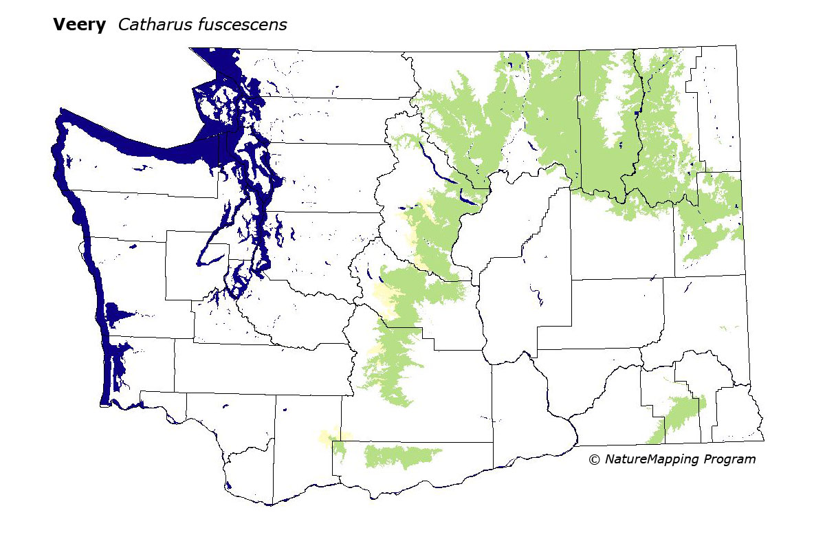
The Veery is common in hardwood riparian zones at low elevations in eastern Washington, especially at the ecotone between the Ponderosa Pine zone and steppe zones. In the eastern Cascades, it is found south to central Yakima County, and locally in Klickitat County.
Core zones were steppes at the edge of the Basin, the Grand Fir zone in the Blue Mountains, and the Ponderosa Pine, Oak, and Interior Douglas-fir zones. Good habitats in all zones were water/wetlands, hardwood forests, and mixed forest.
Washington breeders represent the western subspecies C.f. salicicola. Western records are rare. In eastern Washington, the Veery is common in the Methow and Okanogan valleys, east central Cascades, and in northeastern Washington.
Translated from the Washington Gap Analysis Bird Volume by Uchenna Bright
Text edited by Gussie Litwer
Webpage designed by Dave Lester
 = Core Habitat
 = Marginal Habitat