
Home | About Us | How to Participate | Biodiversity Modules | Projects | Maps | News | Resources
Home | About Us | How to Participate | Biodiversity Modules | Projects | Maps | News | Resources
Species Code: LOLE
Legend: Breeding Range Map Metadata (Data about data or how the map was made) Click to enlarge distribution map
|
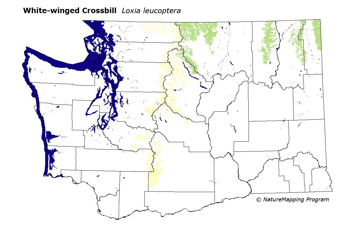
Probable uncommon breeder in the North Cascades and Okanogan Highlands during invasion years. Normally an uncommon winter visitor to Washington. Their abundance depends on local and regional fluctuations in cone crops.
Core breeding areas were Interior Redcedar, Interior Western Hemlock, Subalpine Fir, and Alpine/Parkland zones in the Pasayten and North Cascades regions, and in the Kettle and Selkirk Mountains. Good habitats were all conifer forests except those explicitly labeled early-seral.
Washington breeders represent the nominate North American subspecies L. l. leucoptera. The true breeding status of this species is difficult to determine since it will breed at any time of year if conditions are favorable (abundant food supply). Since most conifers do not produce a suitable cone crop until they are 30 years old, mature forests are an important component of White-winged Crossbill habitat.
Translated from the Washington Gap Analysis Bird Volume by Uchenna Bright
Text edited by Gussie Litwer
Webpage designed by Dave Lester
 = Core Habitat
 = Marginal Habitat